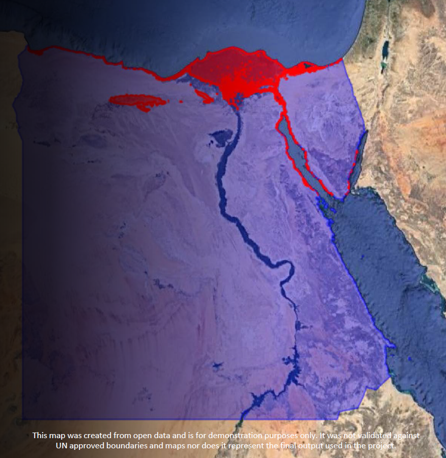
From 13 to 15 October, ESCWA held a regional workshop on the integration of big data and geospatial information for the compilation of SDG indicators in Arab countries, in cooperation with UN Habitat, UNSD, UNEP, UNESCAP and AITRS.
ESCWA presented an overview of the status of integration of data sources in the region, based on a survey addressed to national statistical offices. Findings revealed that most countries were ready for such integration in terms of infrastructure and programming, however many obstacles still hampered the use of big data in the production of official statistics.
Participants discussed those challenges and looked into how geospatial information could be used to collect data for urban indicators; environment indicators; and water, land and agriculture indicators. Successful experiences were presented from several countries, including Bahrain, Denmark, Egypt, Tunisia and the United Arab Emirates.
Read more
News
20 Oct 2020
Integration of big data and geospatial information for the compilation of SDG indicators